


MapXplorer: Navigation, Radar
4.5579.00 Reviews
App Specs
- Version
- 150
- Updated On
- License
- Free
- Downloads
- 10,000,000+
- Developer
- Goldlab Pro
- Categories
- Maps & Navigation
- Platform
- Android, iOS
Screenshots

 Analysis by AppCompare
When I’m somewhere unfamiliar, I want directions I can follow without having to study a screen at every turn. MapXplorer: Navigation, Radar is built around that everyday need, with map browsing, satellite imagery, radar, offline maps and alerts brought together in a navigation app. Its mix may appeal to people who like to look around as they travel, not just get from one address to another.
Readable maps, with a few choices to make
MapXplorer is a free app from Goldlab Pro in the maps and navigation category. It has an average rating of 3.2 from around 24,000 ratings, and more than 10 million installs. Those figures suggest broad reach, but I wouldn’t treat popularity as proof that every part of the experience will suit every traveler. I’d use the app on a familiar route first, then decide whether its map presentation works for me before depending on it somewhere stressful.
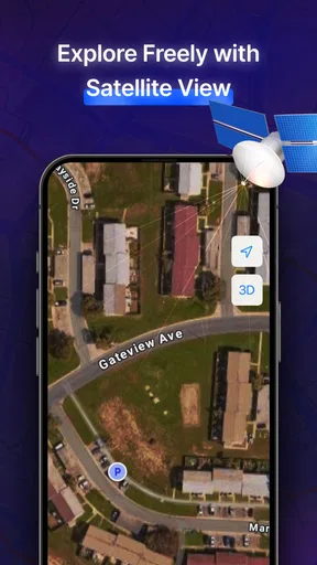
The app offers different map views, including satellite imagery and a more traditional map style. That choice matters for readability: a street-focused view can be easier to scan when following roads, while satellite imagery may help me recognize a landmark or understand the shape of an area. I would switch views before setting off rather than experiment while crossing a busy street or driving. A detailed picture is not automatically a clearer one, especially on a small screen.
The interface is described as straightforward, and the basic map-and-search layout is a sensible starting point for someone who does not want to dig through menus. Still, readability depends on the situation: glare, screen size, visual fatigue and map detail can all change what is comfortable. I’d enlarge the view where possible and pause somewhere safe to check a route. For walking directions, a glanceable screen is useful; for driving, audio guidance is the safer way to reduce repeated screen checks.
Navigation choices for different users
Voice directions can be helpful if looking at a display is difficult or distracting, and they can also reduce the need to keep checking the map. That does not make audio suitable for everyone: a noisy street, hearing differences or a preference for visual cues can make spoken prompts less useful. I would test the guidance style in a calm setting and keep the map available as a backup rather than assuming one channel will work in every context.
Motor needs matter too. Searching, choosing a destination and changing a map view may involve precise taps, and those tasks can be awkward while walking, carrying bags or using a phone one-handed. My practical approach would be to enter the destination and select a view before leaving, then avoid fiddling with controls on the move. Saving favorite places can also reduce repeated searching for regular journeys, though it is most useful when I take a moment to organize those places in advance.
MapXplorer is rated for Everyone, but that label is not the same as a guarantee that its controls or presentation will suit every ability. Anyone who relies on a particular text size, screen reader, high-contrast display or switch-control setup should check the app on their own device before relying on it for an unfamiliar trip. The best test is a short, low-pressure outing: can you find a destination, understand the route and recover comfortably if you miss a turn?
Worth Reading Before You Choose

Flipboard Shows What News Apps Must Do Beyond the Feed

Switching to Android Auto Means Rethinking Your Driving Routine

Google Calendar Makes a Crowded Week Easier to Manage

Ludo King Makes the Most of the Minutes Between Plans

Baby Panda World Brings Quick Play to Modern Phones, but Its Game Library Feels Busy

ESPN’s Live Game View Makes Following Close Games Easier
Offline planning and the radar trade-off
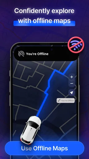
Offline maps are especially useful when mobile coverage is uncertain, but they reward preparation. I’d download the relevant area while connected, then confirm that the map is available before setting off. For a road trip, that means thinking beyond the first destination: the route may cross several areas, so I’d plan which places need to be saved rather than assume one downloaded map covers the whole journey. Offline access can help with the map itself, but it should not be confused with a promise that every live alert or changing detail will work without a connection.
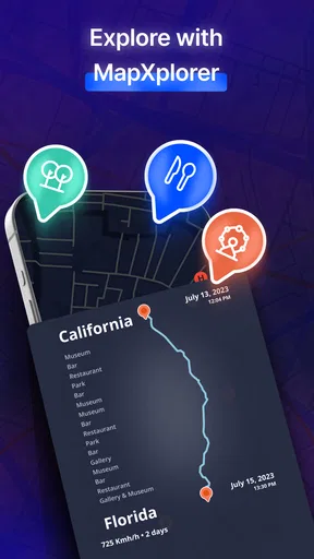
The radar view is a different kind of tool from turn-by-turn navigation. It is intended to surface nearby places and points of interest, which can be useful when I have time to explore. It is less suited to a tightly timed trip where I only need the quickest route. I’d use it before arriving in a neighborhood to spot possible stops, then decide on one destination instead of scanning suggestions while moving. Radar updates may feel slower in rural areas, so I would not make a time-sensitive decision depend on them.
A realistic use would be arriving in an unfamiliar town for an appointment with time left for a break. I could check the map to understand the surrounding streets, use radar to look for a nearby place to stop, and save the appointment location so I can return to it. If coverage is patchy, preparing the offline map first adds reassurance. The trade-off is that discovery tools can invite detours; if punctuality matters, I’d choose the destination in advance and leave browsing for later.
Where it fits among navigation apps
Compared with the usual navigation apps, MapXplorer’s appeal is the combination of offline map use, satellite viewing, radar and real-time alerts. A conventional route-first app may be a better fit if I want a familiar, narrowly focused driving workflow, while a dedicated transit planner may be preferable when exact public transport details are the main priority. The published account of this app describes public transport schedules and routes, but I would still check an important connection against the operator’s current information rather than treat any app as the sole authority.
For a traveler who likes to orient themselves visually and explore nearby places, MapXplorer brings useful kinds of information into one place. For someone who needs highly predictable step-by-step access, the deciding question is not how many features appear on screen but whether the route instructions are easy to perceive and control on their particular device. I would compare it with my current navigation app on a route I already know, paying attention to how quickly I can read the map, change views and return to the route after a stop.
The current version is 109, and it runs on Android 6.0 and later. The app is free to install, with in-app purchases listed at $6.99 to $69.99 per item. I’d look carefully at any purchase screen before confirming anything and start with the free experience to see whether the combination of maps and radar meets my needs. It was released on September 23, 2023, so keeping the app current is a sensible step for anyone using it for travel.
Getting Started with MapXplorer
First off, downloading MapXplorer is a breeze. Available on both Android and iOS, it’s a quick install from the app store. Opening it for the first time, I was greeted with a clean, intuitive interface. No clutter here, just a straightforward design that promises efficiency. The onboarding process is smooth, guiding you through the setup without overwhelming you with information.
The home screen is where the magic happens. You’ll see a map view, your current location, and a handy search bar at the top. It’s all very user-friendly, so if you’re not tech-savvy, you’re still in good hands. The app uses GPS to pinpoint your location, and from there, you can start exploring.
Features That Stand Out
Navigation is obviously the star of the show. What I loved here is the real-time traffic updates. It’s like having a traffic helicopter whispering in your ear. The directions are clear, and the voice navigation is spot on. If you’re someone who gets a bit distracted by visuals, the voice prompts are a lifesaver.
Then there’s the Radar feature. This is where things get interesting. It’s not just about finding your way from A to B; it’s about discovering what’s around you. The radar highlights points of interest like restaurants, gas stations, and even hidden gems like scenic spots. It’s a bit like having a local friend guiding you to the cool spots only they know about.
Also, I have to mention the offline maps. For those times when you’re in the middle of nowhere with zero signal, offline maps are your hero. You can download maps in advance, ensuring you’re never truly lost.
User Experience
The app runs smoothly, with minimal lag even when you’re zipping through the city. The battery usage is reasonable, which is a relief because we all know how navigation apps can sometimes drain your phone faster than a marathon runner. The app integrates well with public transport, offering up-to-date schedules and routes.
Customization is another area where MapXplorer shines. You can personalize your experience with different map views, whether you prefer satellite imagery or a more traditional map look. It even lets you save your favorite places, so finding them again is just a tap away.
What Could Be Improved?
No app is perfect, and while MapXplorer is pretty close, there are a few areas I’d love to see evolve. Occasionally, the radar feature can be a tad slow to update, especially in rural areas. Also, while the app’s design is sleek, a dark mode option could make night-time navigation easier on the eyes.
And while the app does a lot, it could benefit from more integration with other services like Uber or Lyft, making it a one-stop-shop for all travel needs.
The Verdict
So, would I recommend MapXplorer: Navigation, Radar? Absolutely. It’s a robust tool for anyone who loves exploring new places or just needs a reliable navigation app. Whether you’re on a road trip, discovering a new city, or just trying to find the best coffee shop nearby, MapXplorer has got your back.
It’s user-friendly, packed with features, and genuinely makes navigation a breeze. So go ahead, give it a whirl, and let it guide you on your next adventure. Trust me; it’s like having a trusty sidekick who never complains about your music choices.
Who I’d recommend it to
I’d suggest trying it if you enjoy combining route-following with casual exploration, especially when you travel beyond familiar neighborhoods. Its different map views, saved places and offline planning can support a trip where plans change as you go. It may also suit someone who wants to compare a street map with satellite imagery to get a better sense of the area before walking around.
I’d be more cautious if you depend on one specific accessibility setup, need highly current transit details for a connection, or cannot afford uncertainty on a time-critical journey. In those cases, test it alongside a familiar alternative rather than replacing your established routine immediately. A second source for essential directions is not a sign that the app is useless; it is sensible travel planning.
A practical way to try it
Before relying on MapXplorer for a longer outing, I’d try a short route near home. Search for a known destination, check whether the map is easy to read, listen to the prompts in an ordinary environment, and see how comfortable it feels to make a small route adjustment. Then save a frequent stop and test whether it is easy to find again. This quick trial reveals more than judging the interface from its first screen.
For a trip with poor coverage, I’d prepare the offline map before leaving and keep expectations specific: it can provide a useful map when a signal drops, while live information is a separate matter. For sightseeing, I’d use radar while stationary and choose a stop before walking or driving on. Those two habits make the app’s exploratory side more useful without turning navigation into a distraction.
My inclusive take
My overall impression is that MapXplorer gives people several ways to orient themselves, but those options do not automatically remove every barrier. Audio can reduce screen attention; map styles can help different people recognize a route; offline preparation can make uncertain coverage less daunting. At the same time, small-screen controls, busy map imagery, local conditions and individual sensory preferences can all change how usable it feels.
I would treat it as a promising option to test, not as a universal solution. If its voice guidance, map presentation and search flow work for you in a low-pressure trial, its blend of navigation and nearby discovery can be genuinely handy. If they do not, a simpler route-focused app or a specialist transit tool may be the kinder choice. That is the most useful standard for deciding: whether it helps you travel with more confidence, in the situations that matter to you.
Pros
- User-friendly interface for easy navigation.
- Real-time traffic updates enhance accuracy.
- Customizable map themes available.
- Offline maps for remote areas included.
- Voice-guided navigation simplifies trips.
Cons
- Consumes significant battery power.
- Ads can be intrusive for free users.
- Limited features in offline mode.
- Occasional GPS signal loss reported.
- High data usage for online maps.
FAQs for MapXplorer: Navigation, Radar
What features does MapXplorer offer for navigation?
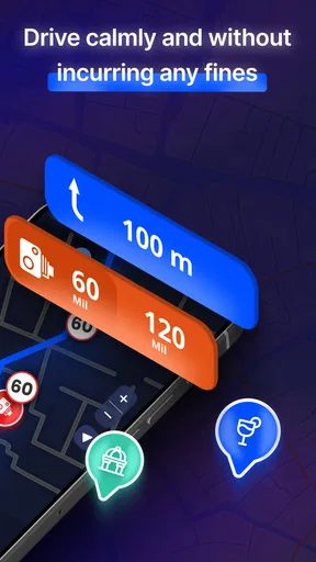
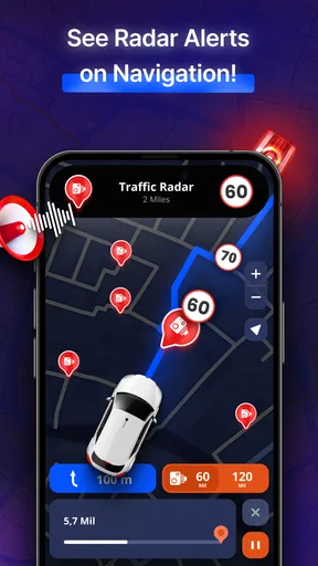
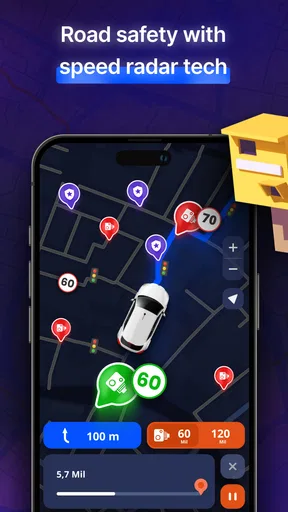
MapXplorer provides real-time GPS navigation, voice-guided directions, and traffic updates. It also includes offline maps for areas with limited connectivity, customizable route planning, and a radar feature for detecting speed cameras. The app's user-friendly interface ensures a seamless experience for drivers, cyclists, and pedestrians alike.
Is MapXplorer available for both Android and iOS?
Yes, MapXplorer is available for download on both Android and iOS platforms. Users can find the app on Google Play Store for Android devices and the Apple App Store for iOS devices. Make sure your device meets the necessary system requirements to ensure optimal performance.
Does MapXplorer require an internet connection to function?
While MapXplorer offers offline maps, some features such as real-time traffic updates and radar alerts require an internet connection. Users should download necessary maps in advance to use the navigation feature without an internet connection, especially when traveling in areas with poor connectivity.
How accurate is the radar feature in detecting speed cameras?
The radar feature in MapXplorer uses a constantly updated database to alert users about speed cameras. While it aims to provide accurate notifications, the effectiveness can vary depending on the region and the frequency of database updates. Always drive cautiously and adhere to local traffic laws.
Is there a cost associated with using MapXplorer?
MapXplorer offers a free version with basic features, but it may include ads. For an ad-free experience and access to premium features like advanced radar alerts and custom route options, users can opt for a subscription plan. Pricing details are available within the app.


